
Stereo analysis
AnalyzedVerdict
Genuine stereo pair92%
The two photographs contain the viewpoint difference needed to produce genuine depth.
- Depth spread
- 4px
- The range of horizontal difference between the two views. More spread generally means more depth; 0–1 px usually indicates a monoview.
- Match
- 88%
- The share of usable picture detail that can be matched between the left and right views. A higher number means a more reliable comparison.
- Vertical
- 1px
- Vertical drift between matched details. Lower is better; 4 px or more can indicate camera movement, scan skew, or poor alignment.
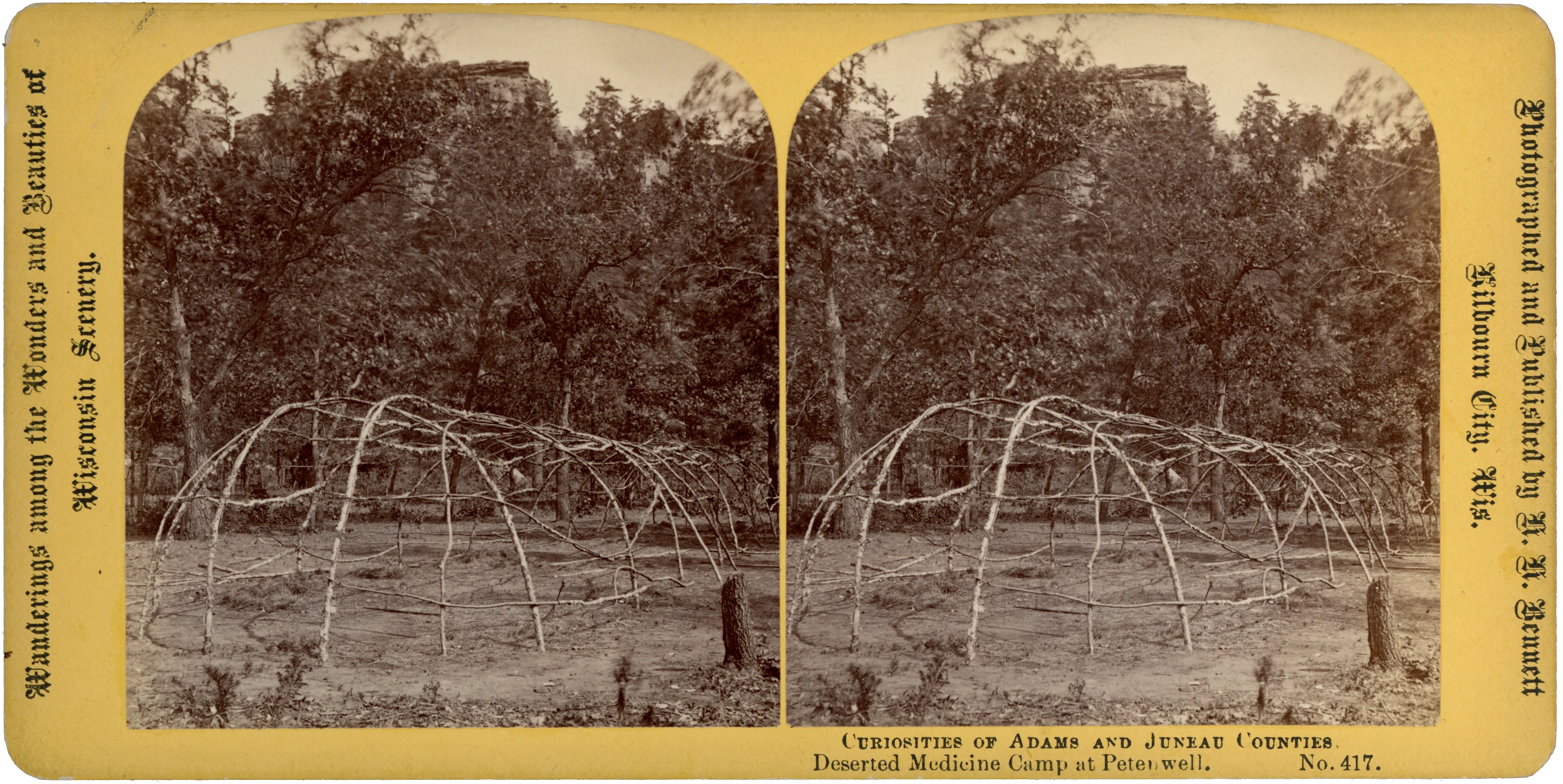
Bent saplings form a low, elongated framework in a woodland clearing, with thinner branches running horizontally between the uprights. Bare ground and a cut stump occupy the foreground; trees partly conceal the layered rock bluff rising behind. No people are visible.
The mount identifies the scene as “Deserted Medicine Camp at Petenwell,” No. 417, beneath the heading “Curiosities of Adams and Juneau Counties.” The right margin reads “Photographed and Published by H. H. Bennett, Kilbourn City, Wis.” The opposite margin carries the series wording “Wanderings among the Wonders and Beauties of Wisconsin Scenery.”
The identification as a medicine camp rests on the publisher’s caption. Neither the caption nor the photograph establishes the Native community associated with the site, a particular ceremony, or the date of the view. The paired, arched-top photographs are mounted on yellow card with rounded corners; the reverse is unprinted apart from a small handwritten pencil notation.
- Title on card
- No. 417. Deserted Medicine Camp at Petenwell.
- Medium
- Stereoview
- Subject
- Native American, Outdoor Scene, Yellow Mount
- Dimensions
- 6.94 × 3.48 in (176.3 × 88.3 mm)
- Condition
- Clean and sound overall, with both photographs intact and no visible cracks or significant staining. Small pencil notation on the reverse.
- Provenance
- Publisher’s imprint on the mount credits H. H. Bennett, Kilbourn City, Wisconsin, as photographer and publisher. No ownership history is established.
- Catalogue no.
- MSV1747
Catalogue details
Location
Petenwell locality, around Petenwell Rock near Necedah — provisional · Juneau County, Wisconsin, United States
General area · Region · 20% confidence
The Smithsonian establishes the photograph’s title, number, and Petenwell place-name, but not its camp footprint or camera position. The historical report places Petenwell Peak near Necedah. The coordinates are Mapcarta’s published location for Petenwell Rock in Juneau County and serve only as a reference point for the proposed locality; no examined source directly ties No. 417 to a particular face or clearing at that rock. Site-level precision is not established. ([sirismm.si.edu](https://sirismm.si.edu/EADpdfs/NAA.PhotoLot.90-1.pdf))