
Stereo analysis
AnalyzedVerdict
Genuine stereo pair91%
The two photographs contain the viewpoint difference needed to produce genuine depth.
- Depth spread
- 4px
- The range of horizontal difference between the two views. More spread generally means more depth; 0–1 px usually indicates a monoview.
- Match
- 86%
- The share of usable picture detail that can be matched between the left and right views. A higher number means a more reliable comparison.
- Vertical
- 1px
- Vertical drift between matched details. Lower is better; 4 px or more can indicate camera movement, scan skew, or poor alignment.
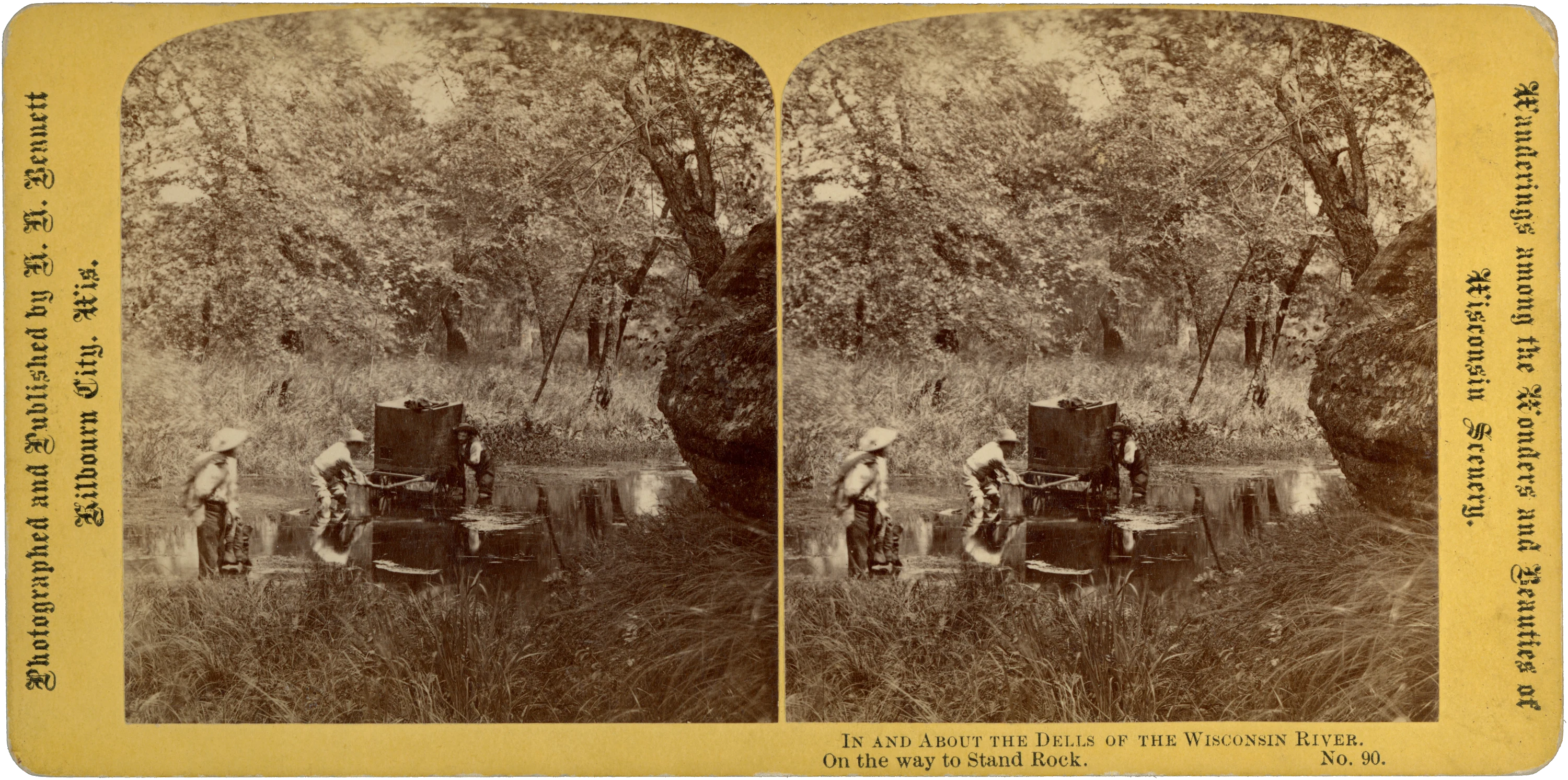
Three hat-wearing figures stand in shallow water around a tall, box-bodied cart in this stereoview by H. H. Bennett. One bends at the projecting handles, another stands beside the box, and the third is nearer the foreground. Grasses line the water beneath dense woodland, while a large rock outcrop closes the view at right. The figures and cart are reflected in the water.
The yellow mount bears the imprint “Photographed and Published by H. H. Bennett, Kilbourn City, Wis.” The lower margin captions the photograph “On the way to Stand Rock,” identifying it as no. 90 in “In and About the Dells of the Wisconsin River.” The right margin carries the broader heading “Wanderings among the Wonders and Beauties of Wisconsin Scenery.”
The printed caption establishes the route but does not name this particular crossing. The three figures remain unidentified, and the cart’s contents and function are not established by the visible details or inscriptions. No date is given on either side of the card.
Clean and sound in the supplied scans, with both images intact and no significant damage visible. The reverse is unprinted apart from small pencil notations.
- Title on card
- No. 90. On the way to Stand Rock.
- Medium
- Stereoview
- Subject
- Outdoor Scene, Yellow Mount
- Dimensions
- 6.97 × 3.46 in (176.9 × 87.8 mm)
- Condition
- Clean and sound in the supplied scans, with both images intact and no significant damage visible. Small pencil notations on the reverse.
- Catalogue no.
- MSV1752
Catalogue details
Location
Approach to Stand Rock, Wisconsin Dells · Wisconsin, United States
General area · Street / district · 60% confidence
The Historical Society identifies the scene as a pond crossing on the way to Stand Rock and associates it with Wisconsin Dells, establishing the broader locality but not an exact crossing, feature footprint, or camera position. ([legacy.wisconsinhistory.org](https://legacy.wisconsinhistory.org/Records?facets=CATEGORIES%3A%22Wisconsin+Historical+Images%22%2CFOR_SALE%3A%221%22%2CFacetSubject%3A%22persons%22%2CFacetSubject%3A%22technology%22%2CCommunity%3A%22Wisconsin+Dells%22&more=FacetSubject%2CCommunity%2CCREATOR_NAME&utm_source=openai)) Coordinates are the published representative coordinates for the Dells of the Wisconsin River, used solely as a regional atlas anchor; they are not coordinates of the photographed pond or Stand Rock. ([en.wikipedia.org](https://en.wikipedia.org/wiki/Dells_of_the_Wisconsin_River)) | Corrected Oct 2026: pin moved from a general Dells reference to the Stand Rock area (USGS GNIS 43.67526, -89.81485); the specific crossing on the route is not identified.