Stereo analysis
AnalyzedVerdict
Genuine stereo pair97%
The two photographs contain the viewpoint difference needed to produce genuine depth.
- Depth spread
- 5px
- The range of horizontal difference between the two views. More spread generally means more depth; 0–1 px usually indicates a monoview.
- Match
- 99%
- The share of usable picture detail that can be matched between the left and right views. A higher number means a more reliable comparison.
- Vertical
- 1px
- Vertical drift between matched details. Lower is better; 4 px or more can indicate camera movement, scan skew, or poor alignment.
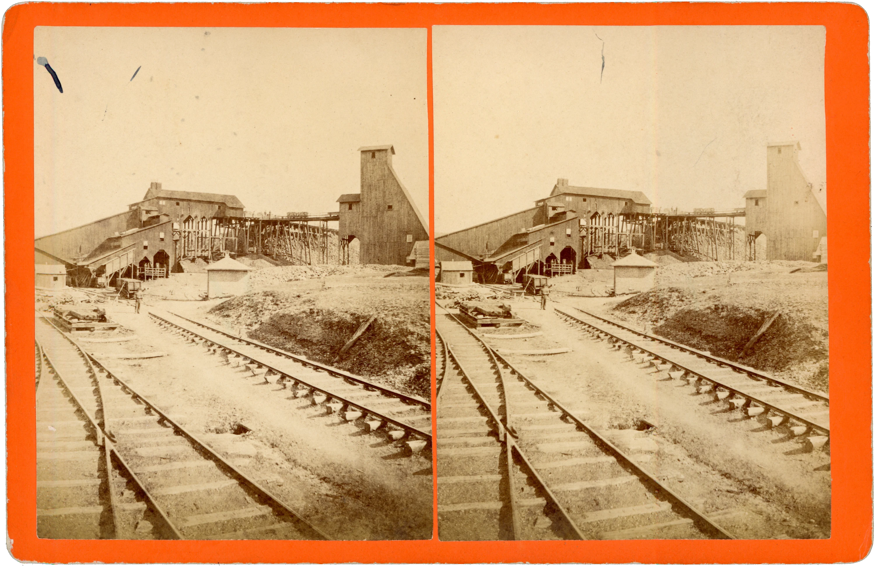
Railway tracks converge toward a substantial group of wooden colliery buildings. Enclosed sloping runs connect with a building raised on timber supports, while an elevated track extends toward the tall structure at right. Small rail wagons stand above the yard; a figure beside the foreground tracks gives scale to the works. The paired photographs are mounted on an orange card with a pink reverse.
The printed reverse label is headed “STEREOSCOPIC VIEWS OF SCRANTON, PA.” and credits the photographs and publication to L. Hensel, Port Jervis, N. Y. Its catalogue identifies this view as “No. 8 Colliery on the Pa. Coal Co.’s Gravity Road.” Scranton is the location supplied by the series heading; the card does not give a street address or a date.
The pencil number “1599” in the label’s number blank matches printed catalogue entry 1599. A heavy ink stroke beneath that entry’s number overlaps the following line. The identification is therefore supported by both the handwritten number and the marked checklist. The next entry, 1600, names “No. 10 Colliery and Plane of the Pa. Coal Co.’s Gravity Road,” followed by a sequence of plane views—a related group documenting the company’s colliery and railway infrastructure.
Several dark marks are visible in the upper sky areas, strongest in the left photograph. Otherwise sound, with the buildings and tracks clearly readable and the reverse catalogue label substantially unobstructed.
- Title on card
- No. 1599. No. 8 Colliery on the Pa. Coal Co.’s Gravity Road.
- Medium
- Stereoview
- Subject
- Mining, Occupational, Outdoor Scene, Railroad
- Dimensions
- 7.01 × 4.54 in (178.1 × 115.3 mm)
- Condition
- Several dark marks in the upper sky areas of both photographs, more conspicuous at upper left. Otherwise sound; the industrial scene remains clear and the reverse label is legible apart from the intentional selection stroke overlapping the next entry’s number.
- Catalogue no.
- MSV1859
Catalogue details
Location
Pennsylvania Coal Co. No. 8 Colliery (No. 8 Shaft), Pittston Township, Luzerne County, Pennsylvania · Pittston Township, Pennsylvania, United States
Photographed subject · Street / district · 60% confidence
Front: "No. 1599. No. 8 Colliery on the Pa. Coal Co.'s Gravity Road." (L. Hensel, Port Jervis). Inspector reports: PCC No. 8 Shaft, Pittston Twp., Luzerne County. Previous pin wrongly sat in Scranton (publisher series heading). NEEDS exact shaft site from period mine map.
Source: Card caption + PA Mine Inspector annual reports (northernfield.info)